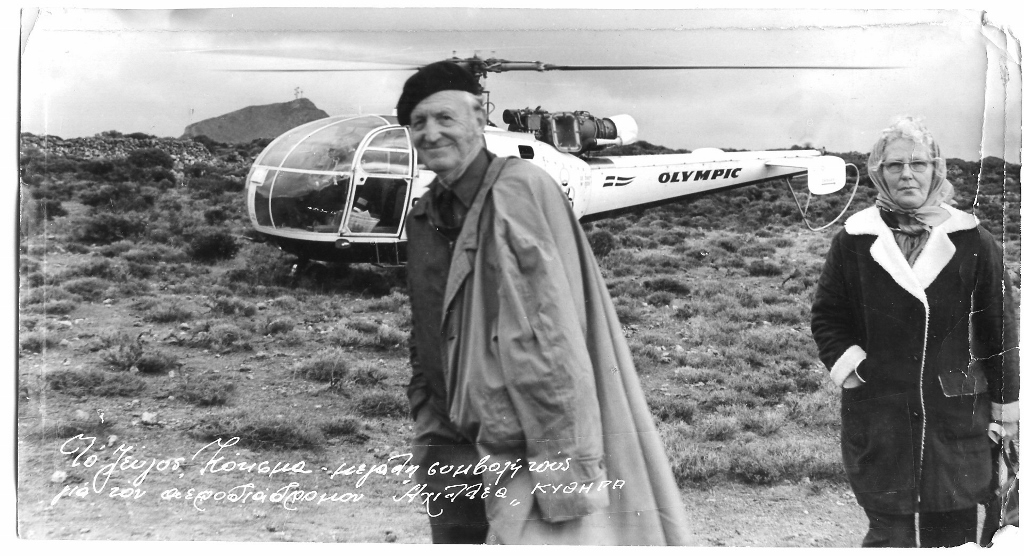
WCC Team-Kythera, 1960 – 1971.
The World Council of Churches, on a request of Bishop Meletios in 1958, sent a team to Kythera to help the Bishop to improve living conditions in his diocese. In The Netherlands the WCC found the Dutch couple George and Anna Koksma available to go and live for at least 10 to 15 years on the island. By the end of April 1960, they both arrived at Kythera and together with the Bishop they set up an extensive 10 point activity program to develop the island. Number 3 on their program list is “Roads and Harbours”. The requirements for an airport were here as well listed later on.
The Technical High School Arnhem, Holland, adopted this development project at Kythera and did sent 2 to 4 technical students for 6 months to the island in the years 1962 up to 1967.
Improvement of the island communication with the mainland.
Harbours: Kapsali, Agia Pelagia, Platia Ammos, Diakofti.
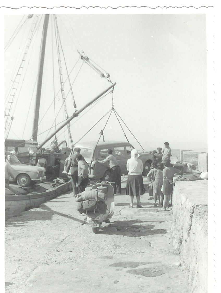
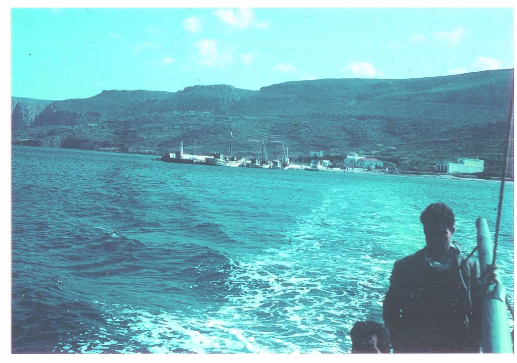
Once a week there is a boat from Piraeus and ‘kaïkia’ take care of freight. There is no mooring facility for the weekly steamer, nor is there on the Peloponnese en route from Piraeus to Kythera! Pending weather conditions, one can disembark with his luggage in small motorized or rowed boats in Kapsali or Agia Pelagia.
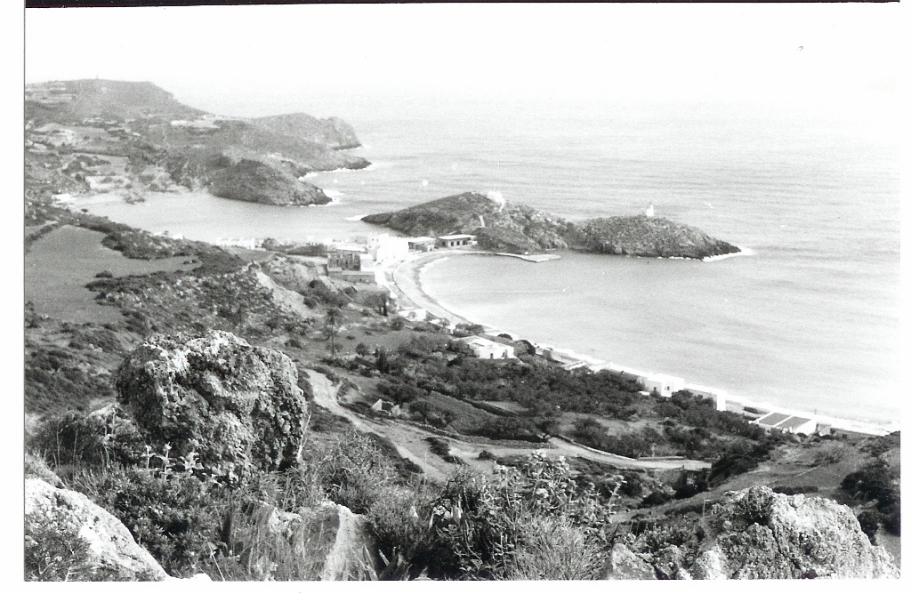
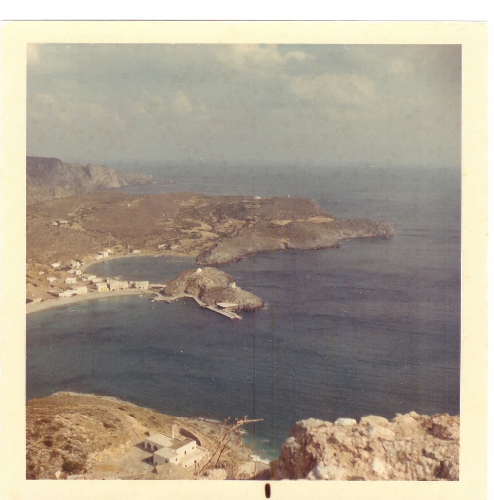
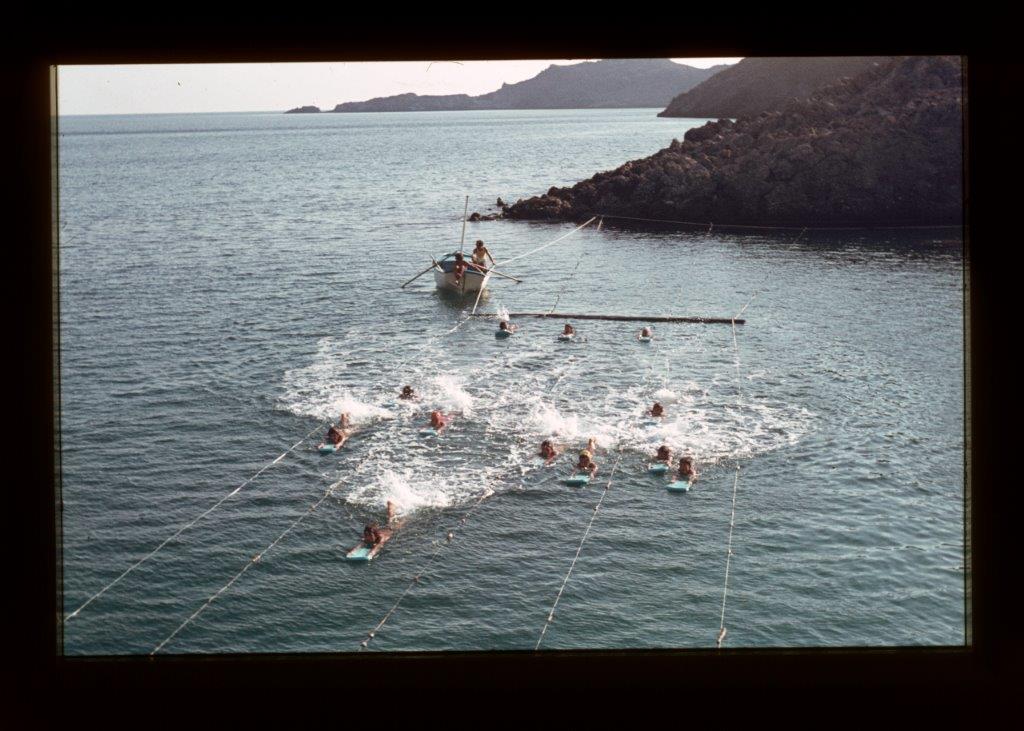
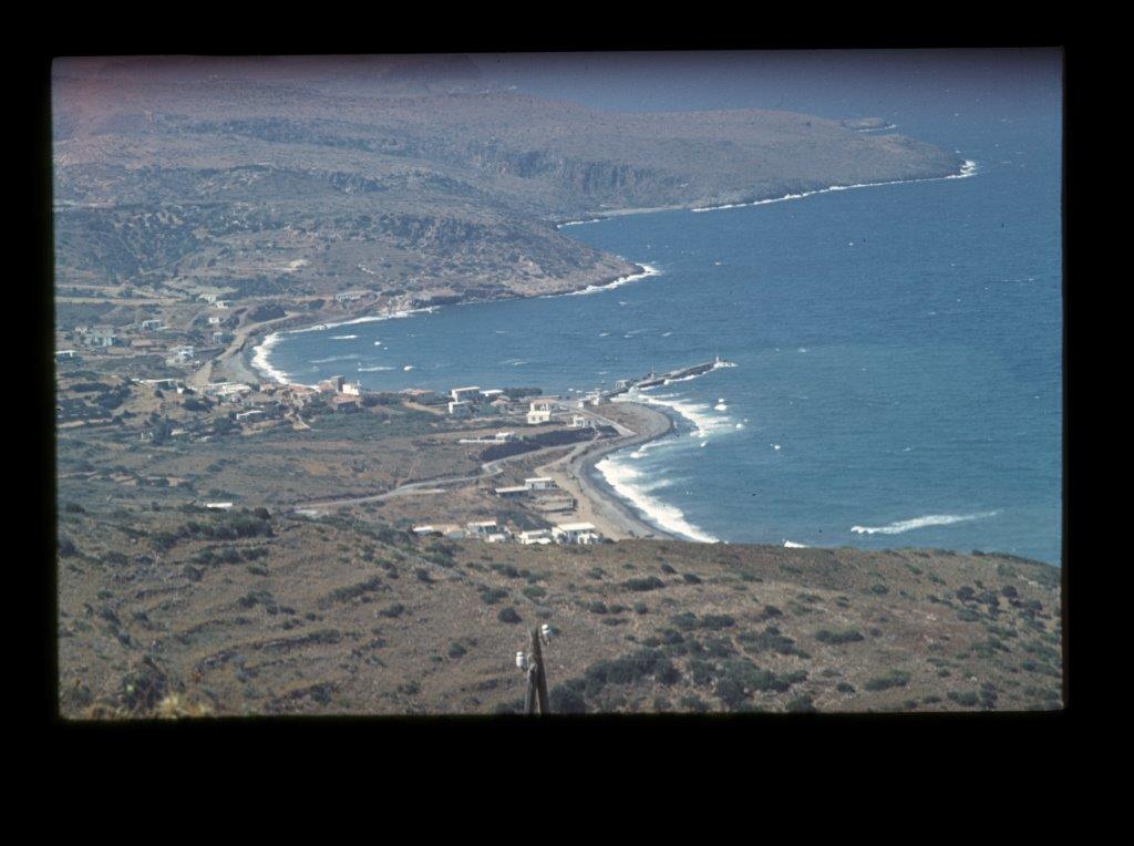
Kapsali.
12 May 1960 George is asked for a design for a protection dam for the small fishing boats that need shelter in stormy weather at Piso Gialo at Kapsali. A survey and a first drawing could only be made after the arrival of the first four technical students from HTS Arnhem, Holland, end of January 1962. The conceptual design for a concrete dam however was more practically executed with large stone boulders. In later years this dam was concreted and a concrete access road was provided. Many fishing boats now find a good and safe shelter.
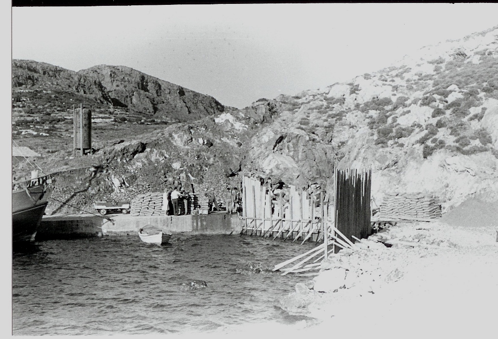
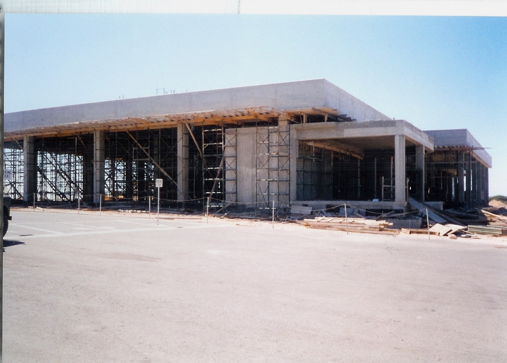
Early April 1962 the brothers Manolli and Vironas Dapontes from Chora mentioned the possibility of extending the existing fisherman’s mole at Kapsali along the rocky shoreline. George’s Team immediately on request surveys the rocky area and the water depths and supplies a plan drawing which design Mr. Manolli Dapontes takes to Athens. With some alterations this design was accepted by the appropriate ministry and construction was started early May. The blessing of this work by the Bishop was 31 May 1962. In later years this jetty in Kapsali was again extended by the Government and a harbour house, Team’s design, was built near the end of the jetty in 1968.
(click on a photo to enlarge)
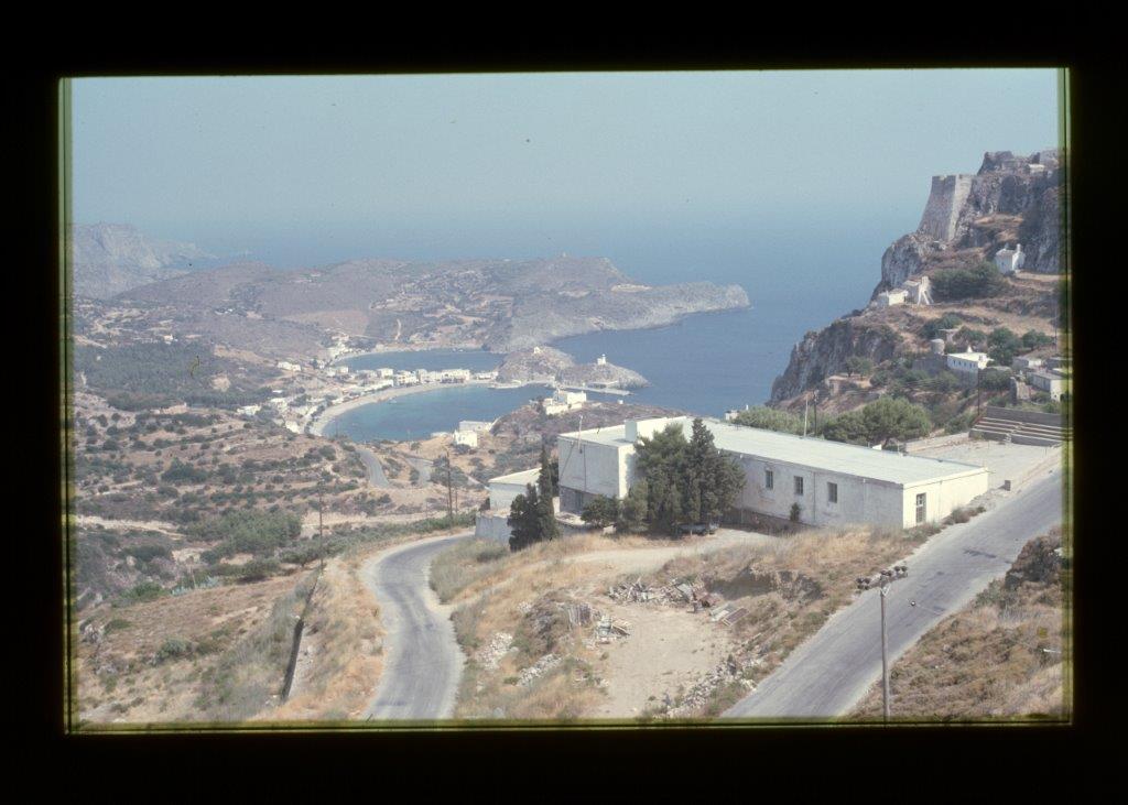
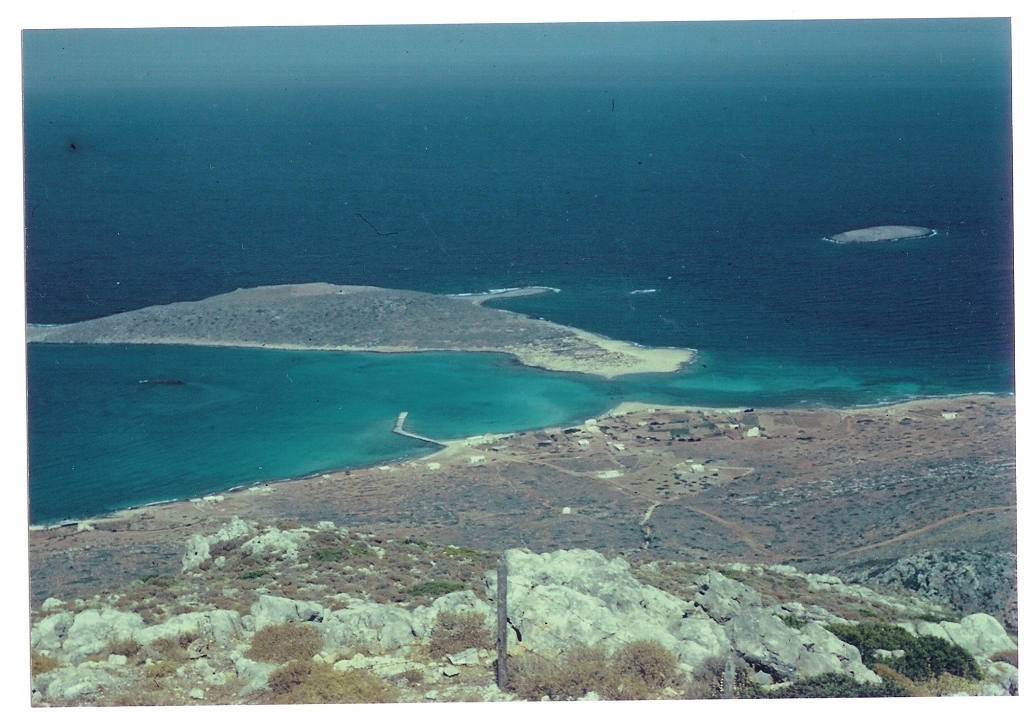
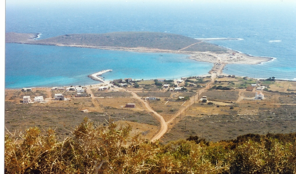
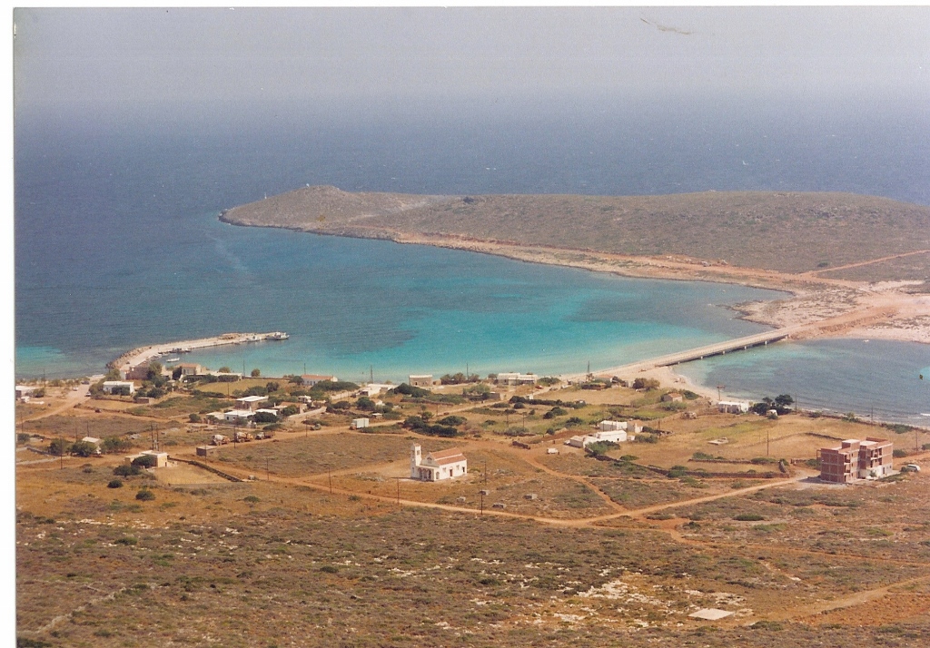
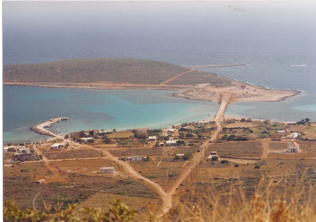
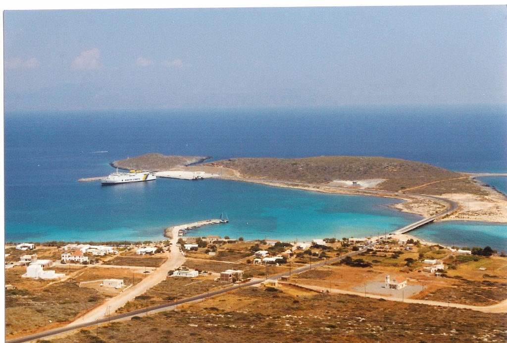
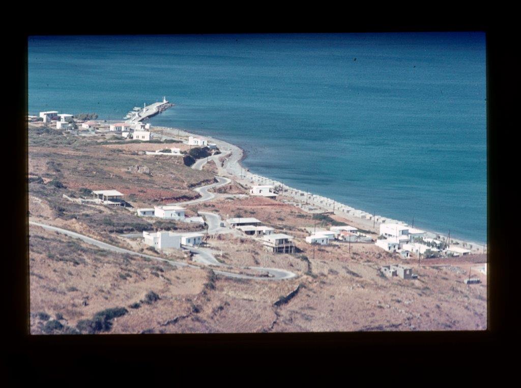
Diakofti.
Quoting from George’s daily work diary of a visit to Diakofti on 6 December 1960: “I wanted to see Makrykythira, the little island where Aphrodite is said to have been born. Must have been in summertime because at other times this small rock is uninhabitable due to weather conditions. The Bishop had blessed the rock and given it the name of St. Paul’s Rock, to avoid a revival of the Aphrodite cult. On arrival a large detonation sounded! Work was started for The Society of Greek Authors who wanted to build an international science and arts center at this small island!”
The general opinion however is that only at Diakofti a safe harbour could be built. The owner of the Purfina petrol station in Fatsadika anticipates on this idea and intends to have an oil tanker stationed in this sheltered bay and asks the Team to do a survey on water depths. At Whitsun 1962 the four technical students of the Team provide him with a detail chart with marked up depths.
In 1963 the Team provides a conceptual design for a bridge to the islet Makrykythira with at mid span a clear height of 3 meters from sea level (project 75-3, drawing number 125, date 18-02-1963), allowing small fishing boats to leave and enter from the south side. But for many years nothing happens with the plans for a safe harbour! The oil tanker however did arrive but very unfortunately capsized within some years and the heavy oil spoiled the sandy beaches and the rocky shores. No real cleaning was done, oily sand was excavated and used as road material for several years.
(click on a photo to enlarge)
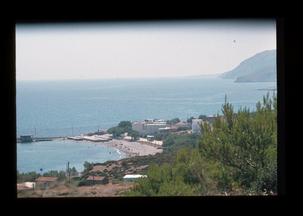
Agia Pelagia.
Now that Kapsali had a mooring facility for the ferryboat from Piraeus also people from Potamos wanted this possibility for their harbour at Agia Pelagia. Some rocks on the sandy bottom in front of the existing jetty caused insufficient bottom depth. Mr. Yiannis Koronaios, son of Mr. Koronaios (‘Poulakis’) who had largely financed the existing jetty, using his scuba diving equipment, dynamited these rocks mid 1966. But the ship’s captain was not yet fully satisfied. The jetty had to be extended! Large concrete blocks were prefabricated and stood for several years on the first beach Firi Ammos, before they were hoisted in place.
(click on a photo to enlarge)
Platia Ammos.
People from Karavas believed that Platia Ammos could become the shortest connection for a future ferryboat from Neapolis on the Peloponnese. A first step for a landing stage was taken by local people in 1965. They leveled part of the rocky shore and concrete was poured. This work was inaugurated by the local papás. Several years later large concrete blocks were prefabricated and they also stood there for may years before they were hoisted in place (Mr. Manolli Dapontes wrote, among other historical interesting books about Kythira, a book in Greek concerning the harbour development of Platia Ammos). When I landed at Platia Ammos in 1983 with the ferryboat from Neapolis, blocks were still visible near the landing stage and even in 1986 I still saw not yet lifted in blocks.
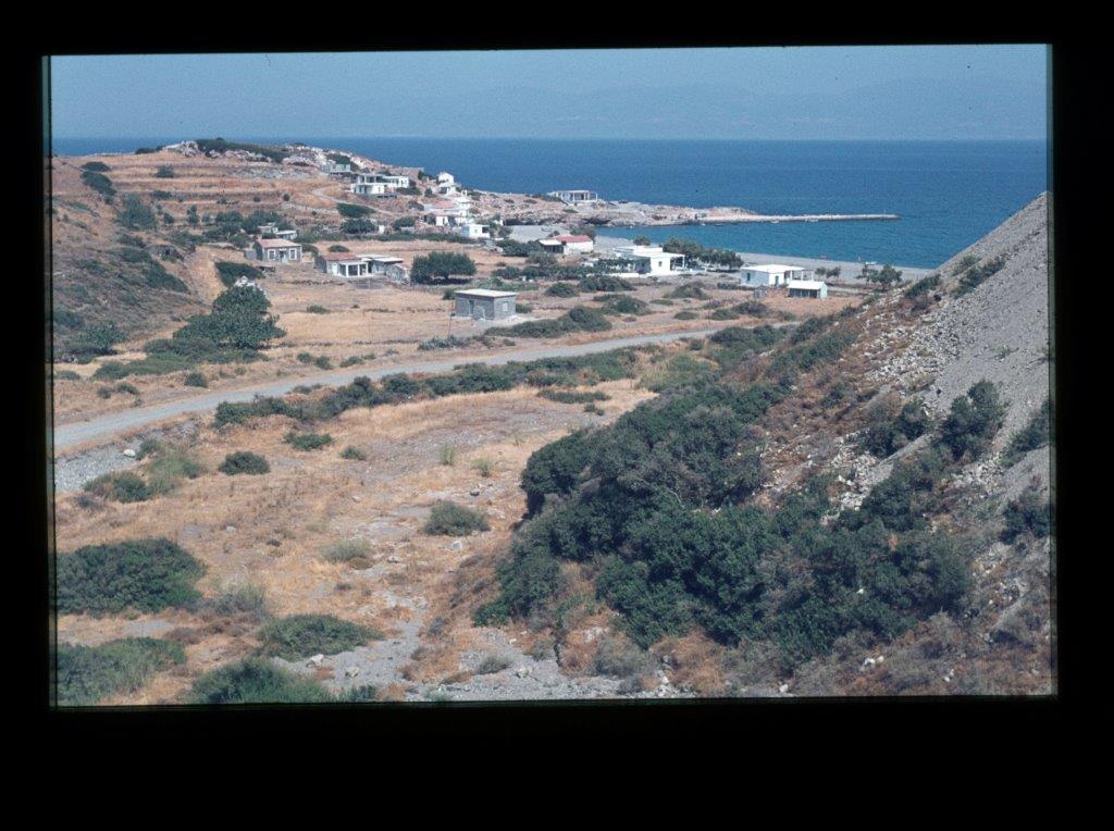
Diakofti at last became Kythira’s main harbour.
The idea remained that only Diakofti had the safest harbour for the ferryboat from Piraeus and the one from Neapolis. Therefore eventually the bridge from Diakofti to Makrykythira is under construction in 1989 and some years later the harbour of Diakofti is a fact.
Airfield.
A first mention of a possibility for an airstrip near Frilingianika can be found in George’s work diary of 3 December 1960. But it took many years before any action on behalf of this subject could be taken. George’s son in law at that time is head of air traffic control at Airport Schiphol, The Netherlands. He provides George with the basic requirements for a small airstrip.
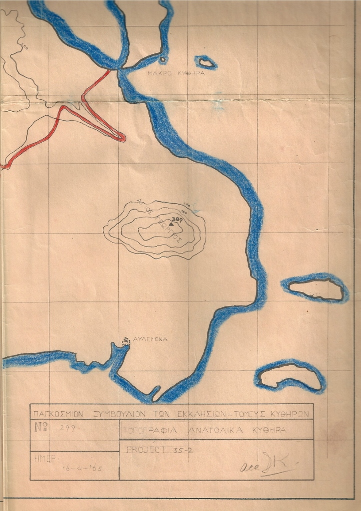
In a letter to the WCC head office in Geneva, about the Team’s achievements up to 17 April 1965, George mentions the following under activity 3: “Together with Mr. Vironas Dapontes we promote plans for an airstrip. This month a permit was granted”.
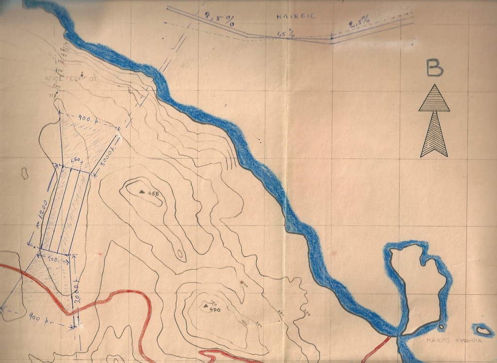
Previously, on request of Mr. Vironas Dapontes, a survey by the two Team’s technical students was done and a conceptual plan drawing prepared by the Team (project 35-2 dwg. Nr. 299 dated 16-04-1965).
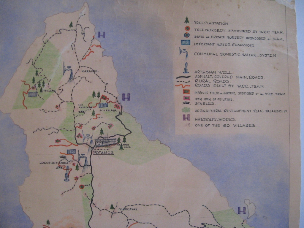
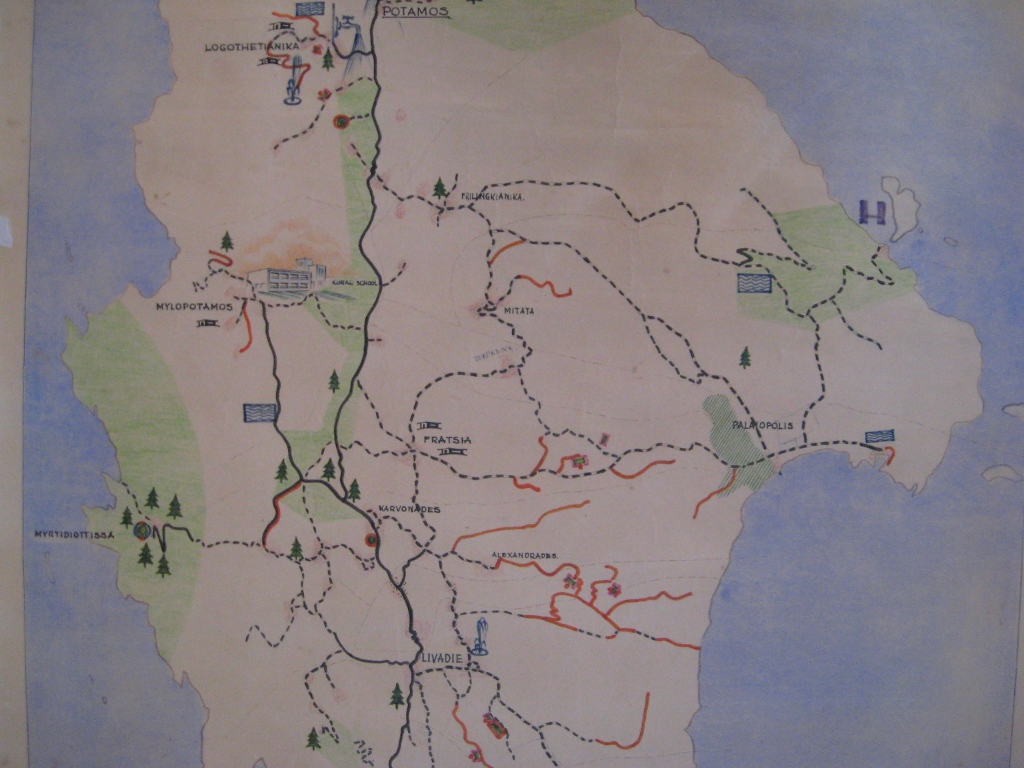
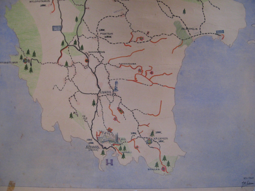
By the end of 1965 George drafts a map of Kythera to show the Team’s achievements of the various ongoing projects up to this period and their future plans. On this map the airstrip however is not yet shown, this is the case one year later.
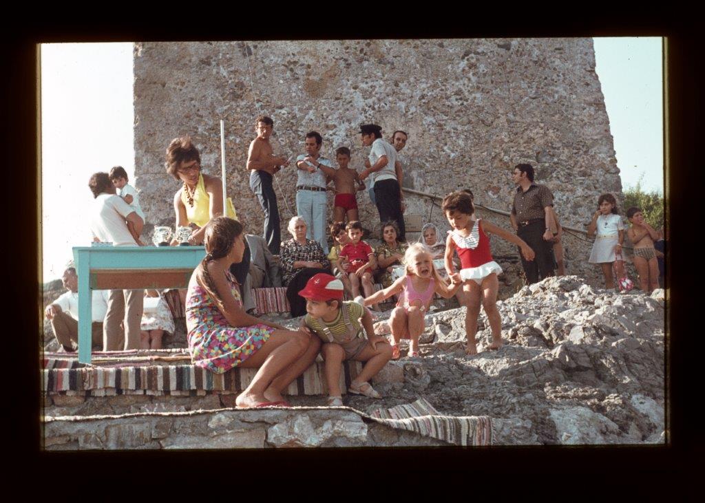
The most logical location according the Team and many islanders is at Amoutses (although several other villages think they also have a chance!), an area within the village of Frilingianika. Through the involvement of Mr. Vironas Dapontes, the driving force behind the plan for an airstrip, instruments are placed in a shack, a stone ‘camara’, that during an extended period 2 times a day, in the morning and in the afternoon, must be read. The gathered information, such as for instance direction and average speed and gusts of wind, must be passed on to the responsible aviation authorities. The president of this village at that time is Mr. Panayiotis Tsitsilias and he is closest to read the instruments. Mr. Vironas Dapontes, living further away in Chora, also regularly goes to Amoutses to read the measurements.
In George’s monthly work report of February 1966, he writes: “first steps and actions for an airstrip can be taken”. In March an area at Amoutses with a length of 1800 m1 has been surveyed and mapped by the Team’s three technical students and a conceptual plan for a runway of 875 x 40 m for this area is drawn later by George (unfortunately no drawing number and date are given).
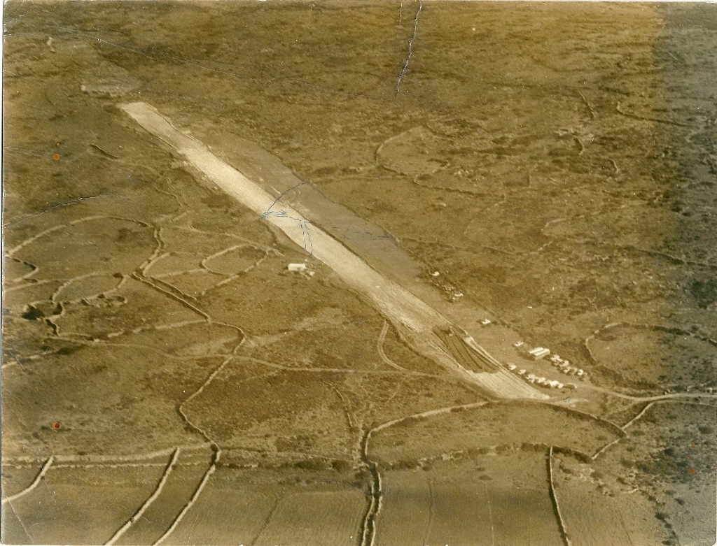
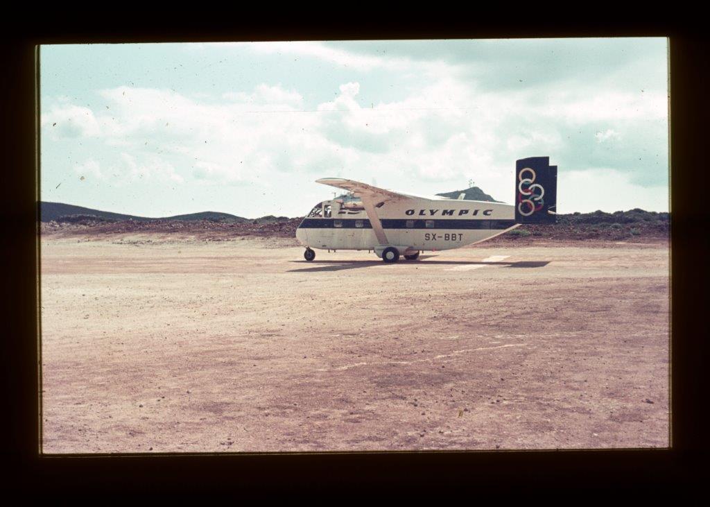
Again, years are passing by, but then on request of Mr. Jimmy Sofios, son of photographer Sofios from Potamos, a very important person on aviation, Alexandros Onassis, the son of Mr. Ari Onassis, visited the island in September 1971 and decided the spot where the airstrip had to be built: at Amoutses near Frilingianika! Immediately at Frilingianika local contractors started bulldozering the indicated area with financial aid of Kytherians from the island, Athens and Piraeus. Just before Christmas 1971 a small airplane, a Skyvan, for the first time can land on the still unpaved airstrip and from 26 December on a regular schedule is kept. The runway was asphalted in 1973.
Initially the properties at Amoutses were donated by their owners to the village and eventually the airport area was donated to the government in April 1981.
Note: I must thank Mr. Panayiotis Samios (‘Kopelli’), secretary of the village council of Frilingianika from 1963/1992, for all the information on the involvement of the village of Frilingianika with the airstrip and supplying me with copies of the Team’s conceptual plans for a bridge at Diakofti (already in 1992) and the airfield (2013).
(click on a photo to enlarge)

Roads.
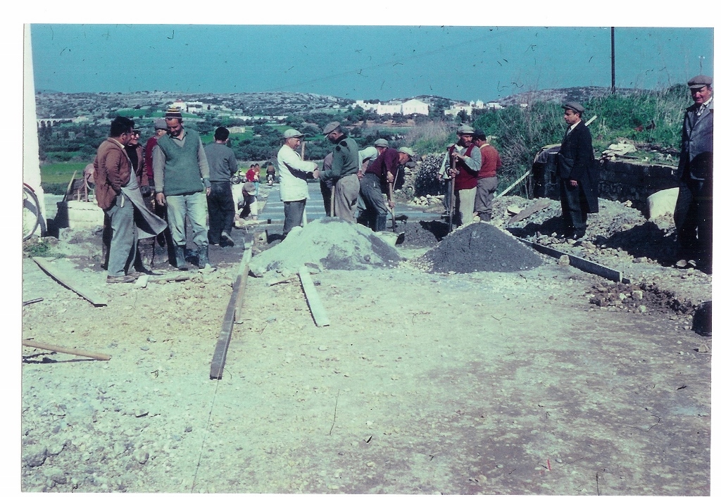
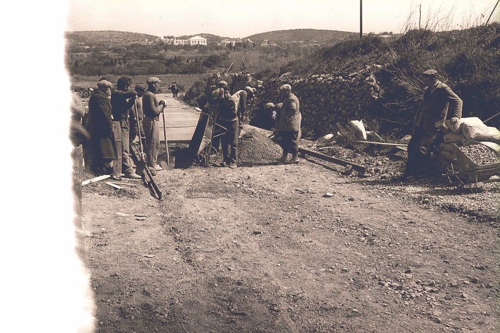
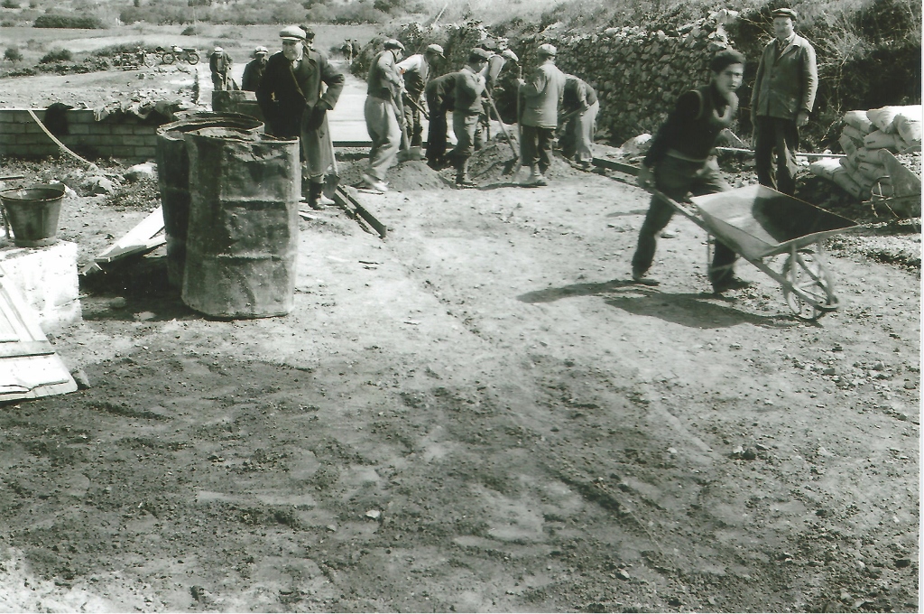
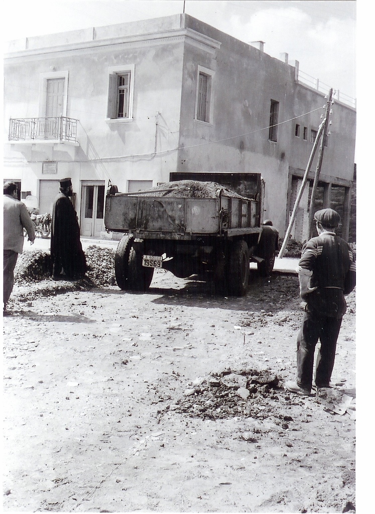
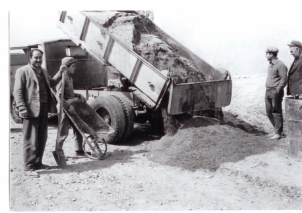
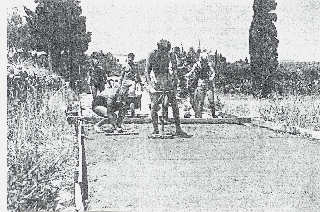
Early July 1960 George is asked to help planning a road from the church Agia Kyriaki near Alexandrades to Paleopolis. When he arrives at the location of the church at 06.30 in the morning some 20 people are already waiting for him. George must make haste with surveying the still unplanned route, because the governmental bulldozer is ordered for the next week! Quickly he learned that it was no use asking for technical requirements on slopes or direction and he therefore started with his leveling apparatus and indicated places where they could put heaps of stone the bulldozer driver could follow later. In this way they staked out some 3500 m. This however was only half the required distance to Paleopolis. During the Team’s being on the island hundreds of kilometers of connecting roads or country tracks were staked out and bulldozered, either by the Government or by the Team’s bulldozer. Of course, not all owners of properties where these new roads went across were happy by having their property split. Many insolated beaches, small fisherman’s coves, vine yards and olive tree locations could be more easily reached, directly or by making extra connecting rural tracks.
(click on the photo to enlarge)

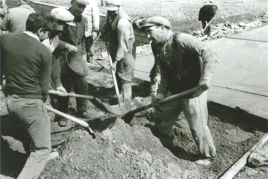
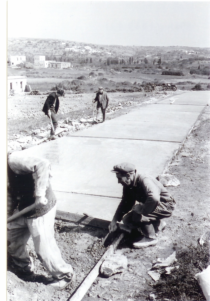
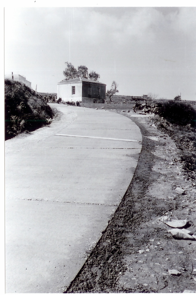
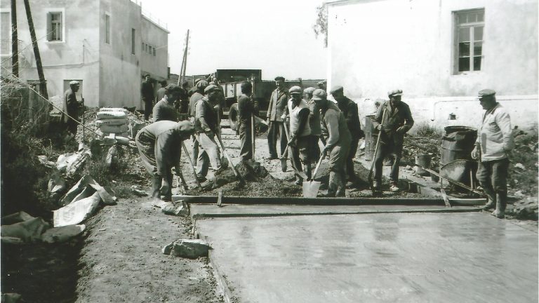
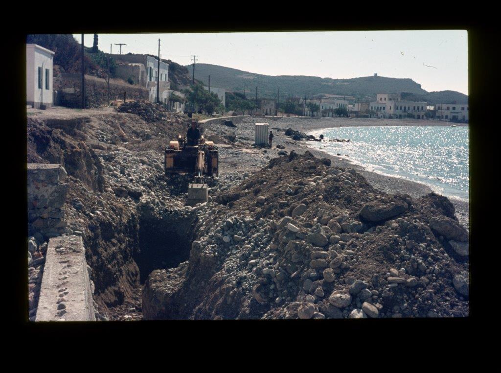
The introduction of concrete paved roads.
For many years there existed only asphalted roads from Kapsali to Chora, Karvounades, Aroniadika, Potamos and from Karvounades to Mylopotamos. By a torrential rainfall autumn 1965 the unpaved village road from Mitata to Viaradika became impassable, a deep gully downhill was scoured by the rain in the centre of the road. In a special report November 1965 on this disaster George puts a plea for help for the people of Mitata which is taken up by Miss Maria de Groot from Zeist, Holland. In a periodical of one of the Dutch churches she expresses her experience walking over this damaged road from Mitata to the water source and washing building halfway down the hill. In her article she asks to start a fund-raising action to collect money for the reconstruction of this road. This action indeed is successful and mounts up to 100.000 drachmas (August 1966), enough money for 1000 m new road. In March 1966 the Team, on request of the people of Livadi, as they had collected money to improve their road from Ano to Kato Livadi, introduced concrete instead of asphalt. This type of pavement did not need expensive machinery and technicians and could be executed by the villagers themselves! At Mitata later in the year, with the experience from Livadi, they now also could repair the road with concrete.
In the Team’s monthly work report for July 1968 furthermore is mentioned that for 3 weeks a small Dutch summer work camp installed more concrete roads at Livadi. They could have achieved more if the supply of materials by the village had been organized in a better way.
Fatsadika, Kythira, August 2013
* interesting read from 1960 onwards and with many historical photos
**click on the photo to enlarge